The mystery of Devil’s Kettle Falls

Judge C. R. Magney State Park is a state park of Minnesota, USA, on the North Shore of Lake Superior.
It was named for Clarence R. Magney, a former mayor of Duluth and judge on the Minnesota Supreme Court, who was instrumental in getting 11 state parks and scenic waysides established along the North Shore.
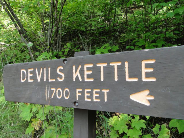
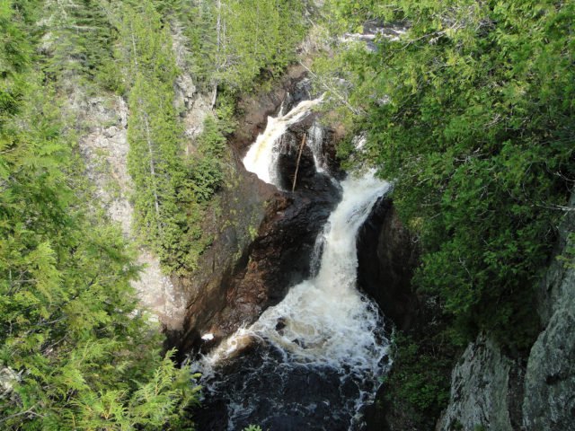
The park is best known for “The Devil’s Kettle”, an unusual waterfall located on the Brule River 1.5 miles (2.4 km) from its mouth. The river splits in two to flow around a mass of rhyolite rock. The eastern flow goes over a two-step, 50-foot (15 m) waterfall and continues downstream.
The western flow surges into a pothole, falling at least 10 feet (3.0 m), and disappears underground. It is believed the water rejoins the main channel of the river or has a separate outlet into Lake Superior, but it has never been located. Researchers have dropped brightly colored dyes, ping pong balls, and other objects into the Devil’s Kettle without result.
There is even a legend that someone pushed a car into the fissure, but given that the Devil’s Kettle is wholly inaccessible by road, most commentators dismiss this as hyperbole.
Not only is the outlet unknown, but there is currently no satisfactory geological explanation for the Devil’s Kettle. Certainly riverbed potholes are known to form from rocks and grit swirling in an eddy with such force that they eventually drill a vertical shaft in the bedrock. How the flow is conducted away laterally, however, remains enigmatic. As geologist John C. Green writes:

One [theory] is that, after dropping down the pothole, the river runs along a fault underground, or as a variant, that it enters an underground channel and comes out somewhere under Lake Superior. Both of these ideas have one valid aspect in common: they recognize that water must move downhill.
But the main problem is creating a channel or conduit large enough to conduct the impressive flow of half the Brule River! Faulting commonly has the effect of crushing and fracturing the rock along the fault plane. This could certainly increase the permeability of the rock — its capacity to transmit water — but the connected open spaces needed to drain half the river would be essentially impossible, especially for such a distance.
Furthermore, there is no geologic evidence for such a fault at the Devil’s Kettle. Large, continuous openings generally do not occur in rocks, except for caves in limestoneterranes. The nearest limestone is probably in southeastern Minnesota, so that doesn’t help… Maybe the Devil’s Kettle bottoms out fortuitously in a great lava tube that conducts the water to the Lake… Unfortunately for this idea, they are not the right kind of volcanic rocks.
Rhyolites, such as the great flow at this locality, never form lava tubes, which only develop in fluid basaltic lava. Even the basalts in this area may not be the “right kind”, being flood basalts that spread laterally as a sheet from fissures, not down the slopes of a volcano. No lava tubes have been found in the hundreds of basalt flows exposed along the North Shore.
Furthermore, the nearest basalt is so far below the river bed, and even if it did contain an empty lava tube (very unlikely after its long history of deep burial) the tube would have to be both oriented in the right direction (south) and blocked above this site so that it isn’t already full of debris. And there are no reports of trees or other floating debris suddenly appearing at one spot offshore in Lake Superior. The mystery persists.