Revealed by Drought the Site of the Spanish “Stonehenge”
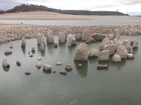
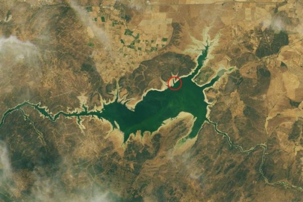
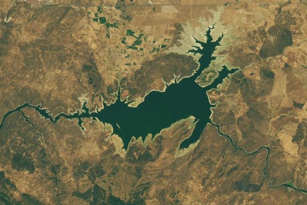
For the last fifty years the Dolmen of Guadalperal, sometimes referred to as the Spanish Stonehenge, has sat under the water of the Valdecana Reservoir in Spain.
It’s a circle made up of nearly 150 stones, and is approximately 7,000 years old. It’s thought that the circle might once have supported a large stone cap to cover the interior ritual space.
It was spotted in images taken from NASA’s Landsat 8 satellite. Its reappearance is being attributed to the record heat and drought that plagued Europe last summer, causing the water levels in the reservoir to make a sharp decline.
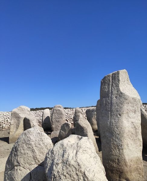
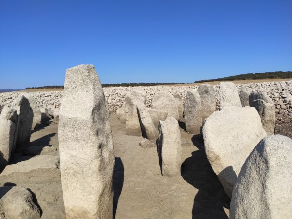
The stones that make up the dolmen are arranged in around a large oval interior space. Some of those tone are of significant size, as much as six feet tall.
There is a particularly large stone making the spot believed to be the entrance to space. One side has a human figure on it, and the other has a curving line that might represent the nearby Tagus River or possibly a snake.
If it is a representation of the river, then it could represent one of the oldest known maps ever drawn.
The first time the site was discovered was in 1925, by a German priest and archaeology hobbyist named Hugo Obermaier.
Later, in 1963, the structure ended up being drowned as the result of Francisco Franco, who ordered a civil engineering project that involved flooding the valley where the dolmen was located.
Ever since then, the site has been a man-made lake next to a hydroelectric dam that’s still in use.
Over the intervening decades, the tops of some of the stones have occasionally been visible as the water level in the lake has fluctuated, but the entire dolmen hasn’t been seen in over fifty years.
It’s not very likely that the site will be fully visible for very long, either, since autumn and winter are the area’s rainy season, and the water level should rise again very soon.
There are local groups who have petitioned to have the stones moved somewhere else so they can be studied, but there are concerns that making such a move could accelerate their decay.
A spokesman for one of the groups interested in moving the stones noted that many people in the area knew they existed, but had never seen them.
Moving them to the shore of the lake would allow them to become a tourist site, attracting visitors to an area which does not currently draw many travelers.
Even if the stones were moved, preservation would be an issue. The stones are made of porous granite, and they have suffered from their long immersion, but relocating them and exposing to them to the elements has its own drawbacks. If they were going to be moved, it would be best to do so before the lake bed begins to refill.
The dolmen bears a strong resemblance to Stonehenge in Wiltshire, England, hence its unofficial name, but the stones in the Spanish circle are of a smaller scale, with the largest being about six feet tall in comparison to the 30-foot pillars of Stonehenge.
There are also more of them, about 144 instead of the 93 at the better-known site. It is, however, believed to have been an Iberian temple dedicated to sun worship, a similar use as the British henge.
In fact, historians believe that the circle may have been built by ancient Celts living in Iberia, according to the Daily Mail.
This is one of several Neolithic sites in Europe which all date from the same general era. Other such monuments were erected in Catalonia, France, Sardinia, and other places in Europe.
The erection of such stone structures began about 6,500 years ago in France, and the practice cropped up in other places as populations migrated. Closer study of the site could provide historians further insight into how the practice of using such structures spread.
Did Vikings Describe Climate Disaster? Viking Runes Gets New Interpretation
The current belief is that early inhabitants of Turkey migrated first to Iberia, and then eventually to the British Isles.


